
Typhoon Bavi Validates the Reliability of BA-FLS-NX5 Floating LiDAR Systems Across Multiple Offshore Projects
Multiple Offshore Projects Face the Challenge of Typhoon Bavi
On July 11, 2026, Typhoon Bavi brought extreme weather conditions to China's southeast coast, affecting multiple offshore wind projects.
During the event, multiple BA-FLS-NX5 floating LiDAR systems deployed by Blue Aspirations operated within the affected area. Several systems were located directly along the typhoon's path, exposing them to severe wind and wave conditions.
The event provided a valuable opportunity to validate the reliability and operational performance of the systems under real offshore conditions.
Typhoon BAVI Monitoring Dashboard Debuts During the Event
Following the typhoon warning, Blue Aspirations immediately activated its emergency response procedures and launched the Typhoon BAVI Monitoring Dashboard.
The dashboard provides real-time visualization of the typhoon track alongside the locations of deployed systems, continuously updating key operational parameters throughout the event. It enables remote monitoring of equipment status and real-time situational awareness during extreme weather.
The successful deployment of the dashboard demonstrated Blue Aspirations' capability for centralized monitoring and rapid emergency response in severe meteorological conditions.
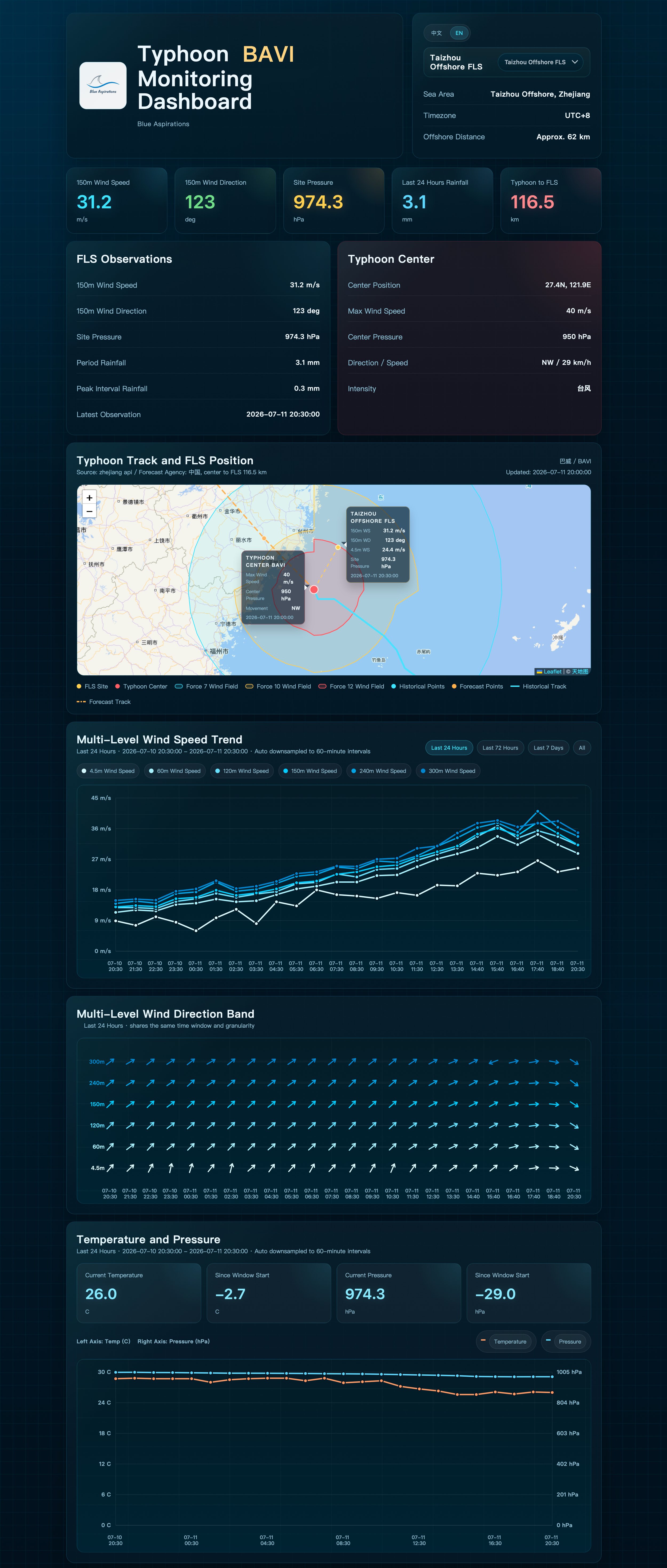
Typhoon Emergency Monitoring Dashboard(Internal Project)
Reliable System Performance Validated by Field Data
Real-time photographs transmitted from offshore sites provided first-hand information for assessing field conditions throughout the typhoon.
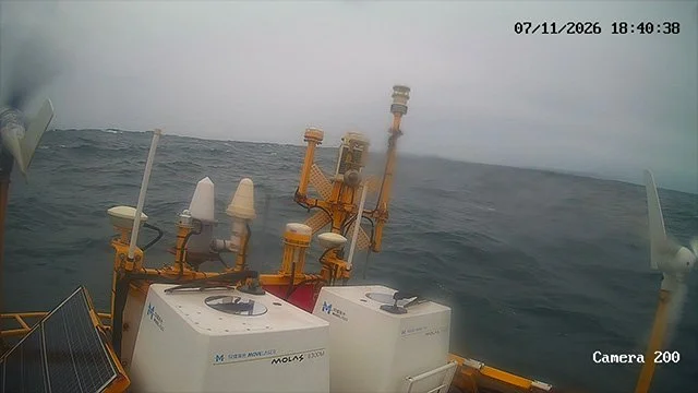
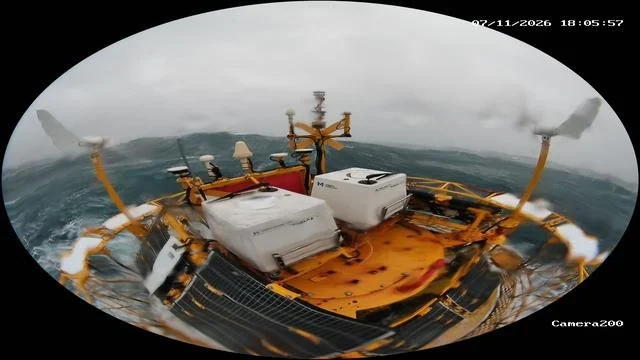
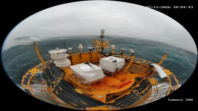
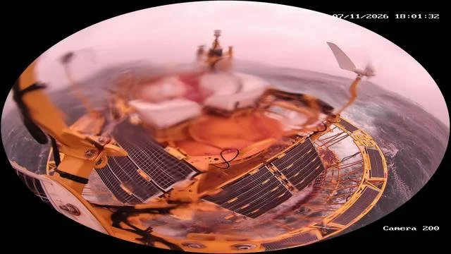
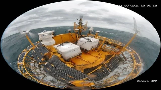
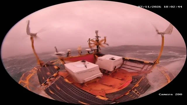
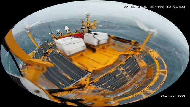
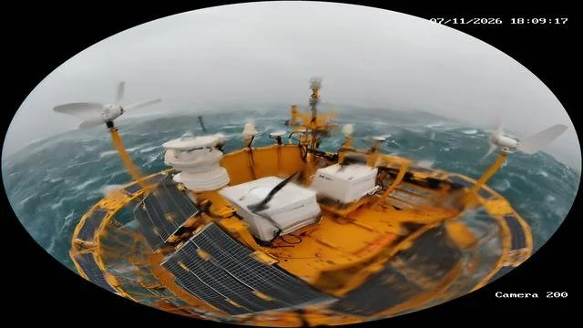
Measured data collected between 08:00 on July 11 and 07:50 on July 12 showed outstanding system performance across all projects.
All eight projects maintained 100% System Availability.
The lowest Data Availability reached 97.92%, while six projects achieved 100% Data Availability.
Average system voltage remained between 25.60 V and 27.57 V, well above the 23.5 V low-voltage threshold, confirming stable power supply throughout the event.
The project located closest to the typhoon center recorded a maximum 10-minute mean wind speed of 50.6 m/s at 300 m, corresponding to 45.3 m/s at 150 m. These measurements significantly exceeded wind speeds recorded by nearby coastal meteorological stations.
As 150 m represents the typical hub height of modern offshore wind turbines, these field measurements provide valuable references for turbine structural design, operational strategy development, and extreme weather assessment.
During the typhoon, several systems experienced temporary operational fluctuations under extreme conditions, including minor wind turbine damage and communication interruptions.
The monitoring system continuously tracked equipment status in real time, automatically identifying abnormal conditions and enabling immediate response actions.
Thanks to the redundant design of critical subsystems—including communications and power supply—localized issues did not affect overall data acquisition or project delivery. Contingency measures ensured that all systems remained safe and under control throughout the event, with no major structural failures.
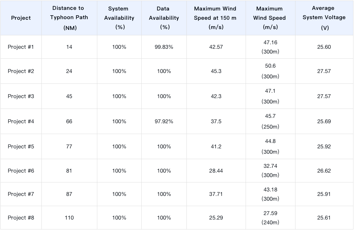
Key Performance Metrics During Typhoon Bavi (July 11, 08:00 – July 12, 07:50)
Demonstrating Reliable Offshore Wind Measurement Capabilities
The successful performance of multiple BA-FLS-NX5 floating LiDAR systems during Typhoon Bavi demonstrated their reliability under extreme offshore conditions.
The event also highlighted Blue Aspirations' capabilities in intelligent monitoring, rapid response, and reliable system design, providing greater confidence in offshore wind measurement for future projects.